I have written several posts about elevation along our 7 mile island;  mainly after hearing the common boast from a home owner that their property is on “the highest point of the island”.
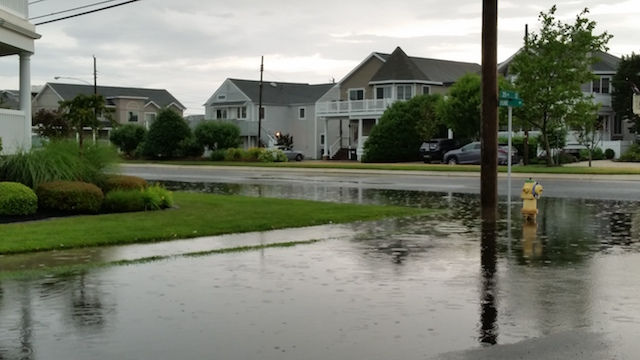
Ironically, one of my tenants heard the opposite after the Friday night rain storm. Â A neighbor (not sure if he is an owner) said the area was the lowest point of the island (not true- but that’s a scary statement for a tenant to hear).
So when our phones start to beep with a weather warning, and the town blasts the flood siren, what should we do?
By the time we hear the “move your car to higher ground” message, some of the lower sections may already be experiencing moderate flooding.
Both Avalon and Stone Harbor distribute flood elevation maps to residents with our tax bills. Â The color coded areas show the low and high sections of our community.
Yet, visitors and newer property owners are not aware of the “higher ground” locations.
Some basics:
1) It may defy logic, but the blocks closer to the beach are typically “higher ground” (although the street in the beach block of 21st Street flooded Friday evening- so it’s not an exact science).
2) Many sections of Ocean Drive/Third Avenue will flood during a heavy rain event.
3) Dune Drive in the Avalon business district has experienced flooding in recent years.
4) The Stone Harbor business district is also vulnerable during storms- best to park closer to Second Avenue.
5) Water in the street may be combination of rain and salt water (from the bay)- damaging to cars either way.
6) Trucks or raised vehicles that are able to clear the water cause wakes that send flood waters into the ground level structures/businesses.
7) Parking a car in a driveway or parking lot is always preferred over street parking because the rain water will accumulate by the storm drains.
Thankfully, the water will drain quickly once a storm passes.
If you have any questions about a particular area of town, I am happy to provide information based on my experience.
Link to Borough of Avalon flood map: MAP


Island Life
I have written several posts about elevation along our 7 mile island;  mainly after hearing the common boast from a home owner that their property is on “the highest point of the island”.
Ironically, one of my tenants heard the opposite after the Friday night rain storm. Â A neighbor (not sure if he is an owner) said the area was the lowest point of the island (not true- but that’s a scary statement for a tenant to hear).
So when our phones start to beep with a weather warning, and the town blasts the flood siren, what should we do?
By the time we hear the “move your car to higher ground” message, some of the lower sections may already be experiencing moderate flooding.
Both Avalon and Stone Harbor distribute flood elevation maps to residents with our tax bills. Â The color coded areas show the low and high sections of our community.
Yet, visitors and newer property owners are not aware of the “higher ground” locations.
Some basics:
1) It may defy logic, but the blocks closer to the beach are typically “higher ground” (although the street in the beach block of 21st Street flooded Friday evening- so it’s not an exact science).
2) Many sections of Ocean Drive/Third Avenue will flood during a heavy rain event.
3) Dune Drive in the Avalon business district has experienced flooding in recent years.
4) The Stone Harbor business district is also vulnerable during storms- best to park closer to Second Avenue.
5) Water in the street may be combination of rain and salt water (from the bay)- damaging to cars either way.
6) Trucks or raised vehicles that are able to clear the water cause wakes that send flood waters into the ground level structures/businesses.
7) Parking a car in a driveway or parking lot is always preferred over street parking because the rain water will accumulate by the storm drains.
Thankfully, the water will drain quickly once a storm passes.
If you have any questions about a particular area of town, I am happy to provide information based on my experience.
Link to Borough of Avalon flood map: MAP